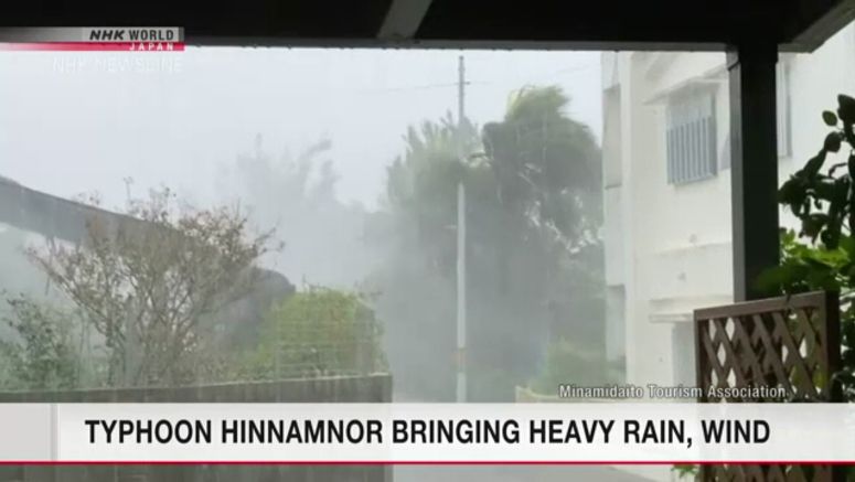
Typhoon Hinnamnor Bringing Violent Winds To Okinawa's Main Island

A powerful typhoon is bringing violent winds to the main island of Okinawa in southwestern Japan.
The Meteorological Agency says Typhoon Hinnamnor was advancing west-southwest over the seas 170 kilometers south of Naha City at 20 kilometers per hour as of 9 p.m. on Wednesday.
The storm had wind speeds as high as 198 kilometers per hour near its center, with gusts of up to 270 kilometers per hour.
Gusts of up to about 92 kilometers per hour were observed in the city of Nanjo on the main island.
The typhoon is expected to develop further, and winds are forecast to intensify on Okinawa's main island and the Sakishima Islands.
The seas around Okinawa's main island and the Amami region are extremely rough. Weather officials forecast rough seas around Sakishima Islands on Thursday. Officials are warning of violent winds and high waves.
Residents in low-lying areas near the coast of Okinawa's main island are advised to take caution against flooding caused by storm surges and high waves.
The typhoon is likely to become stationary over the seas south of Okinawa after approaching the Sakishima Islands on Thursday. It is then expected to move north toward the prefecture again through Sunday.
Gusts and high waves could affect the prefecture for a prolonged period. Western Japan may also be affected, depending on how the typhoon proceeds.
Meanwhile, atmospheric conditions around Japan's main island of Honshu are unstable, as warm, moist air is flowing in from the south. Rain clouds are developing over some parts of western Japan and the Tohoku region. Rainfall is likely to increase in the Hokkaido and Tohoku regions.
Officials are warning of mudslides, flooding of low-lying areas and swollen rivers.